Parafield SA 5106
277 addresses · 12 streets
Makin Electorate › Salisbury LGA › Parafield · 15 km from Adelaide

Living Here
Parafield is a suburb of South Australia, home to about 21 people, with a median age of 22. Common community backgrounds include Australian, Irish, English.
Over time — Census 2011 → 2021
Getting Around & Local Services
6 supermarkets
3 Catholic churches
4 doctors & medical clinics
2 physiotherapists
4 optometrists
2 childcare & kindergartens
2 post offices
1 playground
1 bakery
1 butcher
2 hardware stores
2 hairdressers
Getting around. Train station: Parafield, 1.5 km north-west · Bus interchange: Mawson Interchange, 2.8 km south-west · Airport: Adelaide Airport, 19.2 km south-west.
Tree cover
🌳 Tree canopy: 0.9% share of land under canopy · satellite map, 2020
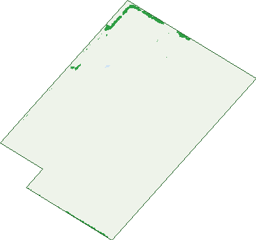
Green: 10 m cells where trees dominate, satellite 2021. Blue: water. The line is the suburb boundary.
| Canopy share, 1 m canopy height map, 2020 | 0.9% |
|---|---|
| Land with trees, 10 m satellite map, 2021 | 1.1% |
Demographics
Unemployment 50% · Labour-force participation 11.8%
Population by age in Parafield
| 0-4 | 0 |
|---|---|
| 5-14 | 0 |
| 15-19 | 4 |
| 20-24 | 6 |
| 25-34 | 3 |
| 35-44 | 0 |
| 45-54 | 0 |
| 55-64 | 0 |
| 65-74 | 0 |
| 75-84 | 0 |
| 85+ | 0 |
Top ancestries in Parafield
| Australian | 6 |
|---|---|
| Irish | 5 |
| Other | 5 |
| English | 4 |
| Aboriginal | 0 |
| Chinese | 0 |
Birds & Wildlife Nearby
34,451 bird observations recorded near Parafield — most often seen:
- Pacific Black Duck (1,563)
- Rainbow Lorikeet (1,505)
- Australian White Ibis (1,436)
- Chestnut Teal (1,349)
- Eurasian Coot (1,347)
- Spotted Turtle-dove (1,310)
- Magpie-lark (1,308)
- Grey Teal (1,287)
- Little Raven (1,271)
- Dusky Moorhen (1,249)
- Australasian Purple Swamphen (1,232)
- Noisy Miner (1,229)
- Superb Fairy-wren (1,196)
Show all 30 birds recorded near Parafield
- New Holland Honeyeater (1,167)
- Crested Pigeon (1,162)
- White-faced Heron (1,158)
- Australasian Grebe (1,153)
- Eurasian Blackbird (1,118)
- Australian Magpie (1,117)
- Red Wattlebird (1,114)
- Little Pied Cormorant (1,070)
- Common Starling (1,021)
- Willie Wagtail (984)
- White-plumed Honeyeater (973)
- House Sparrow (966)
- Rock Dove (925)
- Welcome Swallow (860)
- Royal Spoonbill (831)
- Australian Wood Duck (802)
- Black-tailed Native-hen (748)
Sightings reported by observers, not a survey, so the counts show what people record rather than what lives here. Source: Atlas of Living Australia.
Nearby Suburbs
The closest suburbs to Parafield:
- Para Hills West (1.1 km)
- Salisbury South (1.2 km)
- Para Hills (2.3 km)
- Salisbury East (2.3 km)
- Brahma Lodge (2.3 km)
- Gulfview Heights (2.4 km)
- Salisbury Downs (2.9 km)
- Parafield Gardens (3 km)
Embed this suburb
Add this free Parafield stat card to your own site — just copy the code:
Preview:
Cite this page
Quoting these figures? Copy the credit line:
Keep an eye on Parafield
One email when this data meaningfully changes — new census figures, prices, rankings. No spam, unsubscribe anytime.
Streets
- Anderson Drive (23)
- Butler Avenue (2)
- Dakota Drive (8)
- Horrie Miller Drive (16)
- Kesters Road (2)
- Kings Road (11)
- Kittyhawk Lane (10)
- Lawrence Hargrave Way (116)
- Lockheed Lane (4)
- Mollison Road (1)
- Nobby Buckley Drive (82)
- Tiger Moth Lane (2)