Point Wilson VIC 3212
13 addresses · 4 streets
Corio Electorate › Greater Geelong LGA › Point Wilson · 47 km from Melbourne

Getting Around & Local Services
1 café or restaurant
2 gyms & sports centres
Getting around. Train station: Little River, 7.1 km north · Airport: Avalon Airport, 2.2 km west.
Tree cover
🌳 Tree canopy: 1.7% share of land under canopy · satellite map, 2020
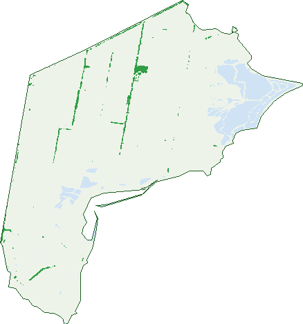
Green: 10 m cells where trees dominate, satellite 2021. Blue: water. The line is the suburb boundary.
| Canopy share, 1 m canopy height map, 2020 | 1.7% |
|---|---|
| Land with trees, 10 m satellite map, 2021 | 1.9% |
Birds & Wildlife Nearby
202,750 bird observations recorded near Point Wilson — most often seen:
- Black Swan (12,834)
- Chestnut Teal (8,814)
- Pacific Black Duck (8,734)
- Hoary-headed Grebe (8,569)
- White-faced Heron (8,427)
- Australasian Purple Swamphen (8,239)
- White-fronted Chat (8,203)
- Welcome Swallow (7,883)
- Grey Teal (7,465)
- Little Raven (7,325)
- Australian Shelduck (7,170)
- Superb Fairy-wren (6,977)
- Swamp Harrier (6,422)
Show all 30 birds recorded near Point Wilson
- Eurasian Coot (6,361)
- Golden-headed Cisticola (6,330)
- Eurasian Skylark (6,322)
- Masked Lapwing (6,313)
- Australian White Ibis (6,056)
- Willie Wagtail (5,802)
- Common Starling (5,626)
- Royal Spoonbill (5,614)
- Magpie-lark (5,416)
- House Sparrow (5,375)
- Brolga (5,348)
- Yellow-billed Spoonbill (5,341)
- Straw-necked Ibis (5,338)
- Sharp-tailed Sandpiper (5,286)
- Great Egret (5,098)
- Whiskered Tern (5,063)
- Australian Magpie (4,999)
Sightings reported by observers, not a survey, so the counts show what people record rather than what lives here. Source: Atlas of Living Australia.
Nearby Suburbs
The closest suburbs to Point Wilson:
- Avalon (5.8 km)
- Little River (7.4 km)
- Lara (9.5 km)
- Corio (13 km)
- North Shore (13.5 km)
- Norlane (14.5 km)
- Lovely Banks (15.5 km)
- Clifton Springs (15.7 km)
Embed this suburb
Add this free Point Wilson stat card to your own site — just copy the code:
Preview:
Cite this page
Quoting these figures? Copy the credit line:
Keep an eye on Point Wilson
One email when this data meaningfully changes — new census figures, prices, rankings. No spam, unsubscribe anytime.
Streets
- Dandos Road (3)
- Point Wilson Road (1)
- Pousties Road (7)
- Princes Highway (2)