Nathalia VIC 3638
1,294 addresses · 91 streets
Nicholls Electorate › Moira LGA › Nathalia · 197 km from Melbourne
📦 Thinking of moving here? Read the Nathalia moving guide

Living Here
Nathalia is a suburb of Victoria, home to about 1,982 people, with a median age of 47. The typical household earns around $1,169 a week, with median rent near $194 a week. Most homes are houses. About 79% of households own their home and 18% rent. Most workers drive to work. Common community backgrounds include Australian, English, Irish. On the ABS socio-economic scale it sits in decile 3 of 10 nationally — a more disadvantaged area. The median house sells for about $397,500.
Over time — Census 2001 → 2021
Dashed line: district figures for the Numurkah statistical area (SA2), the smallest area the ABS published before 2011. Solid line: Nathalia itself.
Getting Around & Local Services
1 café or restaurant
1 supermarket
1 pharmacy
1 hospital
1 library
1 service station
3 gyms & sports centres
1 golf club
1 butcher
1 hardware store
1 hairdresser
1 mechanic
1 place to stay
Getting around. Airport: Echuca Airport, 41.6 km west.
Sport & Recreation
6 facilities recorded in Nathalia.
- Nathalia Bowls Club Lawn Bowls
- Nathalia Golf Course Golf
- Nathalia Lawn Tennis Club Tennis (Outdoor)
- Nathalia Showgrounds and Recreation Reserve Australian Rules Football, Cricket, Netball
- Nathalia Sports & Community Centre & Skate Park Badminton, Basketball, Fitness / Gymnasium Workouts, Skating, Soccer (Indoor Soccer / Futsal)
- Nathalia Swimming Pool Swimming
Socio-economic Standing
Deciles from 1 (lowest) to 10 (highest), against all Australian suburbs. The overall figure weighs advantage and disadvantage together; economic resources counts income and housing, and education & jobs counts qualifications and occupation. They often differ. Source: ABS SEIFA 2021.
Median Sale Prices
Median of recorded sales in the period, not a valuation. Source: Victorian Property Sales Report, Land Use Victoria.
Tree cover
🌳 Tree canopy: 8.5% share of land under canopy · satellite map, 2020
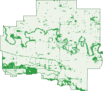
Green: 10 m cells where trees dominate, satellite 2021. Blue: water. The line is the suburb boundary.
| Canopy share, 1 m canopy height map, 2020 | 8.5% |
|---|---|
| Land with trees, 10 m satellite map, 2021 | 13.7% |
Demographics
Unemployment 4.3% · Labour-force participation 55.2%
Population by age in Nathalia
| 0-4 | 94 |
|---|---|
| 5-14 | 222 |
| 15-19 | 135 |
| 20-24 | 107 |
| 25-34 | 191 |
| 35-44 | 191 |
| 45-54 | 221 |
| 55-64 | 304 |
| 65-74 | 275 |
| 75-84 | 158 |
| 85+ | 80 |
Dwelling types in Nathalia
| House | 748 |
|---|---|
| Townhouse | 37 |
| Apartment | 0 |
| Other | 26 |
Households by weekly income in Nathalia
| <$650 | 185 |
|---|---|
| $650-1,499 | 278 |
| $1,500-2,999 | 206 |
| $3,000+ | 94 |
Top ancestries in Nathalia
| Australian | 885 |
|---|---|
| English | 881 |
| Irish | 290 |
| Scottish | 226 |
| Ancestry NS | 101 |
| Aboriginal | 69 |
Housing tenure in Nathalia
| Owned | 368 |
|---|---|
| Mortgage | 257 |
| Rented | 147 |
| Other | 24 |
Cars per household in Nathalia
| 0 | 52 |
|---|---|
| 1 | 245 |
| 2 | 276 |
| 3 | 130 |
| 4+ | 84 |
Commute to work in Nathalia
| Car | 582 |
|---|---|
| Train | 0 |
| Bus | 3 |
| Tram/ferry | 0 |
| Walked | 60 |
| Bicycle | 22 |
| Home | 102 |
Top countries of birth in Nathalia
| England | 30 |
|---|---|
| New Zealand | 17 |
| Philippines | 17 |
| Scotland | 11 |
| United States | 9 |
| South Africa | 8 |
Languages used at home in Nathalia
| Mandarin | 8 |
|---|---|
| Tagalog | 6 |
| Italian | 3 |
Birds & Wildlife Nearby
2,097 bird observations recorded near Nathalia — most often seen:
- Australian Magpie (93)
- Common Starling (90)
- Pacific Black Duck (89)
- Noisy Miner (86)
- Galah (82)
- Magpie-lark (82)
- Striated Pardalote (81)
- White-plumed Honeyeater (80)
- Willie Wagtail (77)
- Welcome Swallow (76)
- White-faced Heron (73)
- Australian Wood Duck (72)
- Dusky Moorhen (71)
Show all 30 birds recorded near Nathalia
- Red-rumped Parrot (70)
- House Sparrow (68)
- Australian Raven (66)
- Australian White Ibis (65)
- Grey Teal (64)
- Black-faced Cuckoo-shrike (63)
- Crested Pigeon (63)
- Eurasian Coot (63)
- Laughing Kookaburra (63)
- Black Swan (62)
- Straw-necked Ibis (59)
- Eastern Rosella (58)
- Grey Shrike-thrush (57)
- Yellow-billed Spoonbill (57)
- Great Cormorant (56)
- Superb Fairy-wren (56)
- Australian Pelican (55)
Sightings reported by observers, not a survey, so the counts show what people record rather than what lives here. Source: Atlas of Living Australia.
Nearby Suburbs
The closest suburbs to Nathalia:
Embed this suburb
Add this free Nathalia stat card to your own site — just copy the code:
Preview:
Cite this page
Quoting these figures? Copy the credit line:
Keep an eye on Nathalia
One email when this data meaningfully changes — new census figures, prices, rankings. No spam, unsubscribe anytime.
Streets
- Baldwin Lane (4)
- Balls Road (8)
- Barmah-shepparton Road (16)
- Barry Street (9)
- Bindon Street (21)
- Birch Court (4)
- Blacksmiths Road (6)
- Blake Street (125)
- Bourke Road (18)
- Bromley Street (23)
- Brooms Road (4)
- Browns Road (1)
- Camp Street (25)
- Cemetery Road (11)
- Centre Road (17)
- Chapel Street (27)
- Church Street (5)
- Ciro Lane (4)
- Cope Street (37)
- Davidson Omalley Court (5)
- Dendy Close (4)
- Dendy Place (4)
- Dillons Lane (26)
- Dohnt Street (8)
- Draper Street (1)
- Elizabeth Street (62)
- Endeavour Court (11)
- Evans Road (6)
- Fairmans Road (1)
- Federation Street (35)
- Flanners Road (1)
- Fraser Street (31)
- Gifford Street (43)
- Griffiths Lane (3)
- Grinters Road (2)
- Harcourt Street (52)
- Hardings Road (10)
- Hawker Street (16)
- Horners Road (7)
- Katamatite-nathalia Road (9)
- Katunga-picola Road (6)
- Kostadt Street (50)
- Lancaster Avenue (11)
- Leafs Road (11)
- Lindsays Road (2)
- Lyles Road (2)
- Manifold Street (16)
- Martin Street (21)
- Mathers Road (6)
- Mccarron Road (1)
- Mcdonell Street (27)
- Mclellands Road (3)
- Mitchell Street (22)
- Moors Road (4)
- Mordens Road (1)
- Muntz Avenue (11)
- Murray Road (5)
- Murray Valley Highway (25)
- Nathalia-waaia Road (11)
- Nicholson Street (4)
- North Street (12)
- Nugent Street (3)
- Odriscoll Road (1)
- Ohares Road (10)
- Ormonds Road (1)
- Park Street (5)
- Paynes Road (5)
- Pearce Street (38)
- Pelling Street (5)
- Peter Clay Road (10)
- Peter Hawkey Road (7)
- Phillip Road (10)
- Pomfrets Road (8)
- Railway Street (14)
- Richardson Street (19)
- Robertson Street (48)
- Ryans Road (15)
- Saxtons Road (2)
- Scolyers Road (5)
- Scott Avenue (19)
- Settlement Boundary Road (4)
- Stickles Road (1)
- Swantons Road (3)
- Tenaces Road (1)
- Thompsons Road (4)
- Tinklers Road (3)
- Tucketts Lane (2)
- Veldt Street (45)
- Venture Court (20)
- Walshs Bridge Road (3)
- Weir Street (30)