Wallaroo SA 5556
3,492 addresses · 145 streets
Grey Electorate › Copper Coast LGA › Wallaroo · 142 km from Adelaide
📦 Thinking of moving here? Read the Wallaroo moving guide

Living Here
Wallaroo is a suburb of South Australia, home to about 3,699 people, with a median age of 57. The typical household earns around $892 a week, with median rent near $245 a week. Most homes are houses. About 67% of households own their home and 31% rent. Most workers drive to work. Common community backgrounds include Australian, English, Scottish. On the ABS socio-economic scale it sits in decile 1 of 10 nationally — a more disadvantaged area.
Over time — Census 2001 → 2021
Dashed line: district figures for the Wallaroo statistical area (SA2), the smallest area the ABS published before 2011. Solid line: Wallaroo itself.
Getting Around & Local Services
2 schools
2 cafés & restaurants
1 supermarket
2 parks
2 beaches
1 Catholic church
1 pharmacy
1 post office
2 service stations
2 golf clubs
1 bakery
1 hardware store
1 hairdresser
Getting around. Ferry wharf: Wallaroo, 1.1 km north-west.
Socio-economic Standing
Deciles from 1 (lowest) to 10 (highest), against all Australian suburbs. The overall figure weighs advantage and disadvantage together; economic resources counts income and housing, and education & jobs counts qualifications and occupation. They often differ. Source: ABS SEIFA 2021.
Tree cover
🌳 Tree canopy: 0.7% share of land under canopy · satellite map, 2020
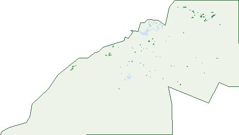
Green: 10 m cells where trees dominate, satellite 2021. Blue: water. The line is the suburb boundary.
| Canopy share, 1 m canopy height map, 2020 | 0.7% |
|---|---|
| Land with trees, 10 m satellite map, 2021 | 0.2% |
Demographics
Unemployment 10.3% · Labour-force participation 40.1%
Population by age in Wallaroo
| 0-4 | 146 |
|---|---|
| 5-14 | 331 |
| 15-19 | 138 |
| 20-24 | 126 |
| 25-34 | 242 |
| 35-44 | 323 |
| 45-54 | 409 |
| 55-64 | 677 |
| 65-74 | 759 |
| 75-84 | 425 |
| 85+ | 122 |
Dwelling types in Wallaroo
| House | 1,444 |
|---|---|
| Townhouse | 112 |
| Apartment | 6 |
| Other | 18 |
Households by weekly income in Wallaroo
| <$650 | 433 |
|---|---|
| $650-1,499 | 642 |
| $1,500-2,999 | 286 |
| $3,000+ | 87 |
Top ancestries in Wallaroo
| Australian | 1,683 |
|---|---|
| English | 1,664 |
| Scottish | 292 |
| German | 254 |
| Ancestry NS | 234 |
| Irish | 227 |
Housing tenure in Wallaroo
| Owned | 677 |
|---|---|
| Mortgage | 350 |
| Rented | 481 |
| Other | 34 |
Cars per household in Wallaroo
| 0 | 94 |
|---|---|
| 1 | 658 |
| 2 | 557 |
| 3 | 142 |
| 4+ | 96 |
Commute to work in Wallaroo
| Car | 791 |
|---|---|
| Train | 0 |
| Bus | 8 |
| Tram/ferry | 0 |
| Walked | 40 |
| Bicycle | 3 |
| Home | 95 |
Top countries of birth in Wallaroo
| England | 155 |
|---|---|
| New Zealand | 24 |
| Netherlands | 23 |
| Scotland | 21 |
| Italy | 15 |
| South Africa | 14 |
Languages used at home in Wallaroo
| Greek | 19 |
|---|---|
| Spanish | 13 |
| Afrikaans | 9 |
| Italian | 7 |
| Russian | 5 |
| Hindi | 4 |
Birds & Wildlife Nearby
7,260 bird observations recorded near Wallaroo — most often seen:
- Common Starling (534)
- Rock Dove (524)
- House Sparrow (508)
- Southern Magpie-lark (471)
- Eastern Crested Pigeon (445)
- Eastern Asian Spotted Dove (428)
- Eurasian Blackbird (421)
- Western Red Wattlebird (415)
- Giinbaywarraymal (410)
- Eastern Galah (295)
- Eastern Yellow-throated Miner (291)
- Southern Willie Wagtail (287)
- Eastern New Holland Honeyeater (264)
Show all 30 birds recorded near Wallaroo
- Eyre Peninsula Australian Magpie (254)
- Eastern White-plumed Honeyeater (245)
- Eastern Welcome Swallow (190)
- South-eastern Singing Honeyeater (149)
- Birds (138)
- Magpie-lark (109)
- Silver Gull (107)
- Spotted Turtle-dove (106)
- Crested Pigeon (92)
- Red Wattlebird (83)
- Willie Wagtail (78)
- Grey Teal (77)
- Singing Honeyeater (73)
- Little Raven (69)
- Welcome Swallow (66)
- White-plumed Honeyeater (66)
- Little Pied Cormorant (65)
Sightings reported by observers, not a survey, so the counts show what people record rather than what lives here. Source: Atlas of Living Australia.
Nearby Suburbs
The closest suburbs to Wallaroo:
- North Beach (3.8 km)
- Jericho (6.2 km)
- New Town (6.6 km)
- Wallaroo Mines (6.7 km)
- Matta Flat (8.1 km)
- Wallaroo Plain (8.1 km)
- Kadina (8.4 km)
- Jerusalem (8.9 km)
Embed this suburb
Add this free Wallaroo stat card to your own site — just copy the code:
Preview:
Cite this page
Quoting these figures? Copy the credit line:
Keep an eye on Wallaroo
One email when this data meaningfully changes — new census figures, prices, rankings. No spam, unsubscribe anytime.
Streets
- Abdureman Street (15)
- Adelaide Street (8)
- Albatross Street (19)
- Alexander Street (42)
- Allan Avenue (5)
- Annie Watt Drive (26)
- Ashton Road (4)
- Athena Drive (30)
- Bagot Street (40)
- Banks Road (5)
- Barbican Close (21)
- Beare Street (11)
- Beaton Street (4)
- Betts Road (2)
- Bingo Street (17)
- Black Diamond Crescent (20)
- Boase Crescent (15)
- Bollmeyer Street (17)
- Bowman Road (8)
- Brenton Street (4)
- Browne Court (13)
- Burke Street (4)
- Burra Street (4)
- Cameron Court (17)
- Cannon Street (14)
- Carleton Crescent (15)
- Chandler Court (23)
- Charles Terrace (61)
- Chatfield Terrace (17)
- Church Street (14)
- Clara Street (64)
- Clarke Street (38)
- Clipper Court (19)
- Coota Road (1)
- Copper Coast Highway (17)
- Cornish Terrace (88)
- Cornwall Street (6)
- Cresco Road (4)
- Cutter Drive (2)
- Daly Street (57)
- Deer Court (18)
- Diagonal Road (40)
- Diedrich Street (16)
- Donaldson Road (2)
- Duncan Street (8)
- East Terrace (81)
- Elder Street (24)
- Elizabeth Street (55)
- Ellis Road (14)
- Emu Street (12)
- England Street (51)
- Ernest Terrace (41)
- Errington Street (35)
- Evans Road N (37)
- Evans Road S (20)
- Falie Avenue (28)
- France Street (8)
- Gardiner Street (21)
- Genoa Place (26)
- George Street (33)
- Gilmore Crescent (120)
- Gouge Street (7)
- Hall Street (11)
- Hamilton Street (18)
- Harbison Road (27)
- Harriet Street (6)
- Harrington Street (17)
- Hay Street (2)
- Heath Road (3)
- Heath Street (8)
- Henry Street (5)
- Herbert Court (7)
- Heritage Drive (173)
- Hughes Street (56)
- Inverness Way (40)
- Investigator Boulevard (16)
- Ireland Street (65)
- Irwin Street (59)
- Irwine Street (60)
- James Street (11)
- Jamieson Way (12)
- Jetty Road (46)
- John Lloyd Street (9)
- John Terrace (20)
- Jones Street (25)
- Kadina Road (41)
- Kapunda Street (7)
- Ketch Place (6)
- Lady Mcdonald Drive (14)
- Lehman Road (7)
- Leonard Street (20)
- Liberator Way (18)
- Lydia Terrace (36)
- Magazine Road (10)
- Mair Street (26)
- Malcolm Court (10)
- Marden Street (13)
- Margaret Street (18)
- Marshall Street (15)
- Matta Street (7)
- Matthew Flinders Drive (34)
- May Street (32)
- Millsteed Street (6)
- Moonta Street (16)
- Oriental Court (21)
- Owen Terrace (67)
- Pamir Court (32)
- Park Terrace (14)
- Phillips Street (15)
- Pommern Way (114)
- Price Street (23)
- Prince Street (56)
- Racecourse Road (3)
- Recycle Way (2)
- Richard Street (1)
- Richardson Avenue (7)
- Rosslyn Road (8)
- Rucioch Road (4)
- Ryan Street (13)
- Santo Terrace (18)
- Schroeder Street (19)
- Scotland Street (55)
- Seabird Court (6)
- Seeley Lane (2)
- Sharples Road (17)
- Sholl Street (6)
- Smith Street (61)
- Spencer Highway (13)
- Spinnaker Court (24)
- Stately Way (142)
- Stirling Street (20)
- Swift Wings Road (4)
- Thomas Street (1)
- Thompson Street (33)
- Thorne Street (12)
- Victoria Street (24)
- Wales Street (21)
- Wall Road (3)
- Wallaroo Plain Road (2)
- Warmington Esplanade (9)
- Wharton Street (15)
- Wildman Street (25)
- William Street (29)
- Windjammer Lane (8)
- Young Street (23)