Seaton SA 5023
6,283 addresses · 152 streets
Hindmarsh Electorate › Charles Sturt LGA › Seaton · 9 km from Adelaide
📦 Thinking of moving here? Read the Seaton moving guide

Living Here
Seaton is a suburb of South Australia, home to about 10,877 people, with a median age of 40. The typical household earns around $1,300 a week, with median rent near $310 a week. Most homes are houses. About 61% of households own their home and 36% rent. Most workers drive to work. Common community backgrounds include English, Australian, Italian. On the ABS socio-economic scale it sits in decile 3 of 10 nationally — a more disadvantaged area. The median house sells for about $1,077,000.
Over time — Census 2001 → 2021
Dashed line: district figures for the Seaton - Grange statistical area (SA2), the smallest area the ABS published before 2011. Solid line: Seaton itself.
Getting Around & Local Services
1 physiotherapist
1 optometrist
2 childcare & kindergartens
1 dog park
3 plumbers
Getting around. Train station: Seaton Park, 300 m north · Bus interchange: Port Dock Interchange, 5.4 km north · Airport: Adelaide Airport, 5.7 km south.
Socio-economic Standing
Deciles from 1 (lowest) to 10 (highest), against all Australian suburbs. The overall figure weighs advantage and disadvantage together; economic resources counts income and housing, and education & jobs counts qualifications and occupation. They often differ. Source: ABS SEIFA 2021.
Median Sale Prices
Median of recorded sales in the period, not a valuation. Source: Metropolitan Median House Sales, Valuer-General South Australia.
Tree cover
🌳 Tree canopy: 5.3% share of land under canopy · satellite map, 2020
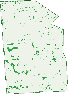
Green: 10 m cells where trees dominate, satellite 2021. Blue: water. The line is the suburb boundary.
| Canopy share, 1 m canopy height map, 2020 | 5.3% |
|---|---|
| Land with trees, 10 m satellite map, 2021 | 2.1% |
Demographics
Unemployment 5% · Labour-force participation 58.1%
Population by age in Seaton
| 0-4 | 610 |
|---|---|
| 5-14 | 1,040 |
| 15-19 | 511 |
| 20-24 | 657 |
| 25-34 | 1,782 |
| 35-44 | 1,359 |
| 45-54 | 1,342 |
| 55-64 | 1,320 |
| 65-74 | 1,054 |
| 75-84 | 776 |
| 85+ | 429 |
Dwelling types in Seaton
| House | 3,012 |
|---|---|
| Townhouse | 1,115 |
| Apartment | 393 |
| Other | 5 |
Households by weekly income in Seaton
| <$650 | 985 |
|---|---|
| $650-1,499 | 1,411 |
| $1,500-2,999 | 1,286 |
| $3,000+ | 563 |
Top ancestries in Seaton
| English | 2,760 |
|---|---|
| Australian | 2,560 |
| Italian | 2,259 |
| Other | 1,469 |
| Greek | 644 |
| Irish | 610 |
Housing tenure in Seaton
| Owned | 1,361 |
|---|---|
| Mortgage | 1,369 |
| Rented | 1,610 |
| Other | 112 |
Cars per household in Seaton
| 0 | 430 |
|---|---|
| 1 | 1,859 |
| 2 | 1,482 |
| 3 | 469 |
| 4+ | 218 |
Commute to work in Seaton
| Car | 3,640 |
|---|---|
| Train | 61 |
| Bus | 156 |
| Tram/ferry | 18 |
| Walked | 44 |
| Bicycle | 34 |
| Home | 372 |
Top countries of birth in Seaton
| Italy | 555 |
|---|---|
| India | 457 |
| England | 284 |
| Greece | 142 |
| Bosnia & Herzegovina | 102 |
| Croatia | 101 |
Languages used at home in Seaton
| Italian | 815 |
|---|---|
| Greek | 354 |
| Punjabi | 277 |
| Serbian | 221 |
| Arabic | 157 |
| Vietnamese | 90 |
Birds & Wildlife Nearby
37,018 bird observations recorded near Seaton — most often seen:
- Rock Dove (2,063)
- Rainbow Lorikeet (1,993)
- Common Starling (1,534)
- Noisy Miner (1,529)
- Australian Wood Duck (1,477)
- Dusky Moorhen (1,470)
- Little Pied Cormorant (1,396)
- Australasian Purple Swamphen (1,363)
- Little Raven (1,362)
- Southern Magpie-lark (1,359)
- Magpie-lark (1,313)
- Little Black Cormorant (1,277)
- Pacific Black Duck (1,258)
Show all 30 birds recorded near Seaton
- Spotted Turtle-dove (1,250)
- Australian Magpie (1,241)
- Giinbaywarraymal (1,226)
- Eastern Crested Pigeon (1,201)
- Eastern Welcome Swallow (1,189)
- Eurasian Coot (1,107)
- Southern Willie Wagtail (1,104)
- Silver Gull (1,053)
- Eastern New Holland Honeyeater (1,028)
- White-faced Heron (1,018)
- Crested Pigeon (935)
- Australian White Ibis (924)
- House Sparrow (913)
- Red Wattlebird (903)
- Australasian Grebe (890)
- Common Mallard (829)
- White-plumed Honeyeater (813)
Sightings reported by observers, not a survey, so the counts show what people record rather than what lives here. Source: Atlas of Living Australia.
Nearby Suburbs
The closest suburbs to Seaton:
- Woodville West (1.4 km)
- Grange (1.7 km)
- Findon (1.8 km)
- Albert Park (2 km)
- Woodville South (2.1 km)
- Kidman Park (2.3 km)
- Royal Park (2.3 km)
- Hendon (2.3 km)
Embed this suburb
Add this free Seaton stat card to your own site — just copy the code:
Preview:
Cite this page
Quoting these figures? Copy the credit line:
Keep an eye on Seaton
One email when this data meaningfully changes — new census figures, prices, rankings. No spam, unsubscribe anytime.
Streets
- Agnes Street (26)
- Ailsa Avenue (16)
- Airdrie Avenue (75)
- Albert Street (25)
- Alfred Avenue (106)
- Alma Place (16)
- Alma Terrace (41)
- Anthony Street (17)
- Arthur Street (10)
- Ayr Avenue (27)
- Bach Crescent (23)
- Balcombe Avenue (34)
- Ballater Avenue (46)
- Barrey Avenue (16)
- Beatrice Avenue (33)
- Bowen Avenue (9)
- Boyce Street (11)
- Brenthorpe Road (77)
- Brice Street (30)
- Buchan Street (22)
- Bunker Court (7)
- Cairns Avenue (8)
- Campbell Avenue (13)
- Carey Avenue (33)
- Carley Crescent (16)
- Carter Place (19)
- Caruso Avenue (6)
- Childs Avenue (15)
- Clarice Avenue (32)
- Clark Terrace (72)
- Commane Avenue (17)
- Corio Avenue (5)
- Crane Place (11)
- Crosby Avenue (3)
- Dawkins Avenue (24)
- Dora Avenue (11)
- Dumfries Avenue (79)
- Dundee Avenue (28)
- Eagle Place (11)
- Elaine Avenue (39)
- Fairway Drive (28)
- Falkirk Avenue (22)
- Fidock Avenue (34)
- Fifth Avenue (3)
- Findon Avenue (95)
- First Avenue (33)
- Flavel Street (21)
- Florey Street (16)
- Foot Avenue (14)
- Fortrose Avenue (72)
- Fourth Avenue (43)
- Frederick Road (186)
- Glenburnie Street (116)
- Gleneagles Court (19)
- Golfers Avenue (149)
- Grange Road (165)
- Green Avenue (93)
- Gregory Crescent (38)
- Gurrs Road (5)
- Hallville Street (22)
- Hamish Court (4)
- Harold Street (26)
- Harris Place (26)
- Hector Street (24)
- Heron Place (14)
- Honeyton Street (73)
- Isabel Court (8)
- Janet Street (20)
- Jennifer Street (11)
- Jessie Avenue (14)
- Karra Avenue (35)
- Kelly Avenue (6)
- Kingborn Avenue (118)
- Kinross Avenue (23)
- Ladd Street (10)
- Lambros Avenue (6)
- Lanark Avenue (45)
- Lark Avenue (25)
- Lawhill Avenue (11)
- Lefkas Court (27)
- Leven Avenue (87)
- Levistone Street (73)
- Lily Avenue (21)
- Lothian Avenue (26)
- Marinoff Street (30)
- Martins Road (48)
- Matthews Avenue (109)
- Mcallan Avenue (28)
- Mcewan Avenue (17)
- Mcmahon Place (33)
- Mcmurray Avenue (17)
- Mcmurtrie Place (11)
- Mcnab Place (8)
- Mcneilly Crescent (24)
- Meakin Terrace (46)
- Middleton Drive (72)
- Mill Street (23)
- Milvera Terrace (1)
- Minns Street E (53)
- Minns Street W (37)
- Mitchell Street E (60)
- Mitchell Street W (38)
- Montrose Avenue (75)
- Morley Road (85)
- Munro Avenue (29)
- Oliphant Avenue (10)
- Olive Street (16)
- Owen Street (28)
- Pape Avenue (16)
- Parker Avenue (44)
- Parkhouse Avenue (38)
- Pedlar Street (96)
- Percy Street (29)
- Peters Way (12)
- Pioneer Street (22)
- Prior Avenue (17)
- Pudney Street (46)
- Raymond Avenue (78)
- Reedbeds Court (7)
- Rositano Avenue (23)
- Ruby Avenue (19)
- Russ Avenue (133)
- Seaton Terrace (203)
- Second Avenue (31)
- Selkirk Avenue (64)
- Service Road (16)
- Shandon Avenue (55)
- Singleton Avenue (21)
- Sixth Avenue (2)
- Slade Place (17)
- Small Street (4)
- South Parade (33)
- Sparrow Court (8)
- Squires Avenue (56)
- Stevens Street (63)
- Tapleys Hill Road (504)
- Third Avenue (30)
- Todville Street (14)
- Traphen Court (5)
- Traphen Street (5)
- Trapp Avenue (26)
- Trimmer Parade (241)
- Troon Avenue (63)
- View Avenue (91)
- Wedge Court (18)
- West Lakes Boulevard (5)
- Wilford Avenue (45)
- Willcocks Avenue (82)
- Winser Avenue (30)
- Wisdom Street (22)
- Witungka Lane (9)
- Yalpara Avenue (26)