Macquarie Pass NSW 2577
6 addresses · 2 streets
Whitlam Electorate › Shellharbour LGA › Macquarie Pass · 93 km from Sydney

Getting Around & Local Services
1 park
2 golf clubs
Getting around. Train station: Robertson, 6.5 km south-west · Railway halt: Summit Tank, 7.2 km north-east · Airport: Shellharbour Airport, 12.1 km east.
Tree cover
🌳 Tree canopy: 85.4% share of land under canopy · satellite map, 2020
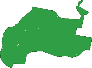
Green: 10 m cells where trees dominate, satellite 2021. Blue: water. The line is the suburb boundary.
| Canopy share, 1 m canopy height map, 2020 | 85.4% |
|---|---|
| Land with trees, 10 m satellite map, 2021 | 99.9% |
Birds & Wildlife Nearby
7,048 bird observations recorded near Macquarie Pass — most often seen:
- Lewin's Honeyeater (437)
- Grey Fantail (363)
- Eastern Whipbird (347)
- Crimson Rosella (340)
- Pied Currawong (328)
- Eastern Yellow Robin (320)
- Laughing Kookaburra (318)
- Satin Bowerbird (318)
- Brown Thornbill (303)
- Eastern Spinebill (298)
- Superb Lyrebird (267)
- Yellow-faced Honeyeater (259)
- Australian Magpie (255)
Show all 30 birds recorded near Macquarie Pass
- White-throated Treecreeper (236)
- White-browed Scrubwren (233)
- Superb Fairy-wren (232)
- Brown Gerygone (217)
- Australian King-parrot (209)
- Australian Raven (203)
- Grey Shrike-thrush (202)
- Australian Wood Duck (152)
- Black-faced Monarch (145)
- Silvereye (142)
- Striated Thornbill (138)
- Grey Butcherbird (134)
- Spotted Pardalote (134)
- Fan-tailed Cuckoo (133)
- Wonga Pigeon (131)
- Yellow-throated Scrubwren (128)
- Willie Wagtail (126)
Sightings reported by observers, not a survey, so the counts show what people record rather than what lives here. Source: Atlas of Living Australia.
Nearby Suburbs
The closest suburbs to Macquarie Pass:
- Mount Murray (2.5 km)
- Tongarra (4 km)
- Robertson (6 km)
- East Kangaloon (6.5 km)
- Knights Hill (6.7 km)
- Marshall Mount (7.9 km)
- Calderwood (8 km)
- North Macquarie (8.3 km)
Embed this suburb
Add this free Macquarie Pass stat card to your own site — just copy the code:
Preview:
Cite this page
Quoting these figures? Copy the credit line:
Keep an eye on Macquarie Pass
One email when this data meaningfully changes — new census figures, prices, rankings. No spam, unsubscribe anytime.
Streets
- Clover Hill Road (2)
- Illawarra Highway (4)